


Google this morning announced that they have released an update which will allow you to use Google Maps for Android to navigate your way around the internal layout of over 200 locations within Australia.
The new feature covers Shopping Centres, Museums, Sporting venues, Airports and more, and has been rolling out in other territories worldwide since early 2012 – it’s nice to see this feature come to Australia.
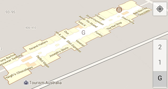
Indoor Maps includes the ability to use the familiar blue dot within the app to narrow down your approximate location within the building up to and including which floor you’re on, and update the map accordingly.
This is just the beginning – Google intends to expand the feature to include more public buildings soon, so look forward to the layout of your favourite location coming soon.


how does it know your location indoor? I assume GPS isn’t available, using wifi?
Google maps uses your mobile or Wifi and not GPS.
it’s good I can use it in Highpoint shopping centre 🙂
shopping centres and train stations in sydney CBD have had this for a while….
WA will be late again coming to the party
Woah! Suprise? Yes.. this isn’t a Sydney first.. or a Melbourne first feature. Casuarina Square – IN DARWIN. w00t. Not that you’d get lost there 😉 It’s interesting that our new addition already has more locations that many other countries on the list.
Just noticed this appears to only work on phones. My tablet shows the regular map as does the web – they are a shitload more accurate and detailed than before however. If you look at locations in the US you can see the floor plans although you are unable to change floors.