Even in Australia which appears to have very few active cases in the community people are nervous about how they are going to travel from one location to another safely. In the latest Google Maps update Google are introducing new features to “help you easily find important information if you need to venture out, whether it’s by car or public transportation.”
Public Transport
Google Maps will now show you relevant alerts from the local public transport agencies with these alerts rolling out in Argentina, Australia, Belgium, Brazil, Colombia, France, India, Mexico, Netherlands, Spain, Thailand, United Kingdom and the U.S. with more coming soon.
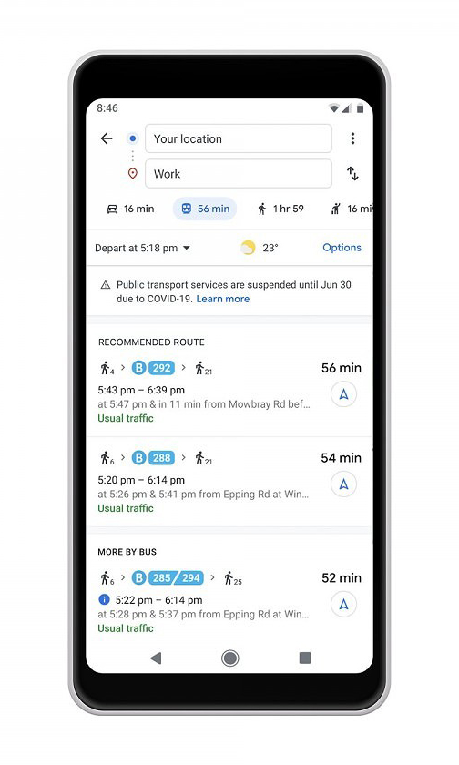
These alerts will tell you if services have been suspended or such things are a requirement to wear a mask (which probably wouldn’t be a bad idea for those in Australia). Maps will also allow you to provide information on how crowded the public transportation you are on is — obviously the more crowded the less social distancing that is occurring.
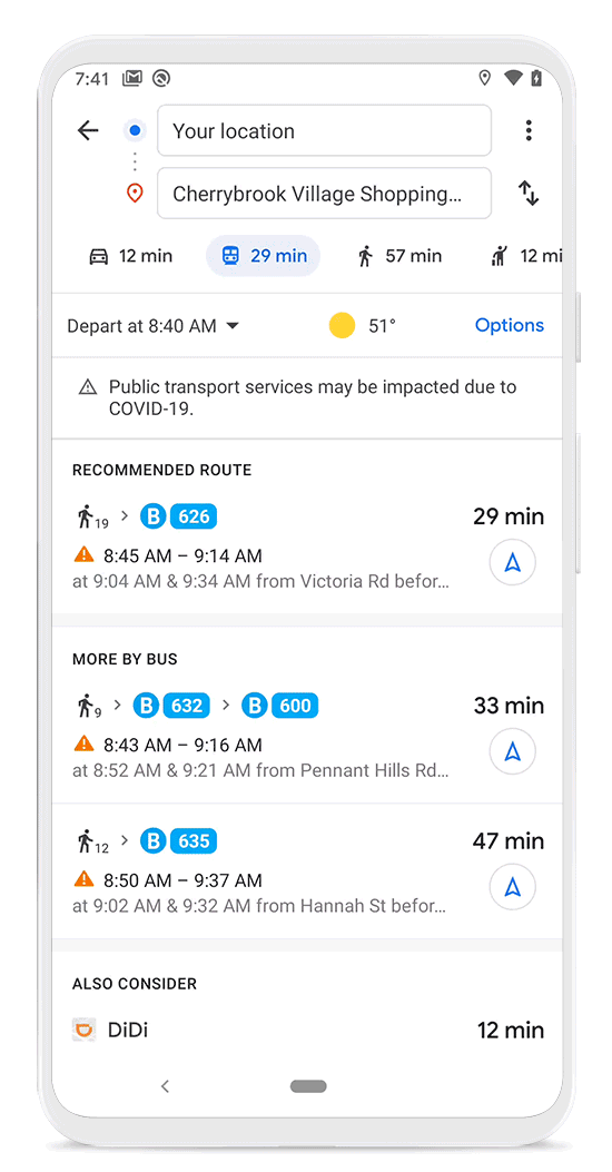
Google is also adding how crowded their ride and transit station will be at the time they are there. Now Google will show you when the station is historically more or less busy. You can also look at live data showing you how busy it is at that moment compared with normal. Just search for a particular station to show this information or tap on the station on a map to see the busyness data along with the departure board.
In the next few weeks these powers are going to improve with the anonymised data from users who have opted in to Google Location History. This is not available yet but will be when there is sufficient data to meet privacy thresholds.
For those who require accessibility information they’ve now added granular controls to allow you to find and contribute things such as where there are wheelchair accessible doors, seating, stop buttons and more.
Private transport
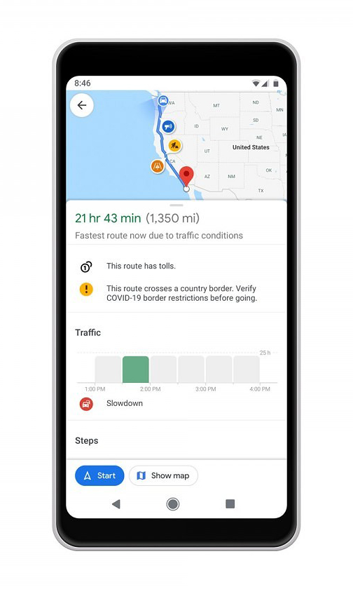
For those travelling by car etc Google will start giving you driving alerts to notify you about COVID-19 checkpoints and restrictions along your route — such as crossing state borders that are still closed here in Australia. An alert will display on the directions screen after starting navigation if your route is impacted by any of these restrictions.
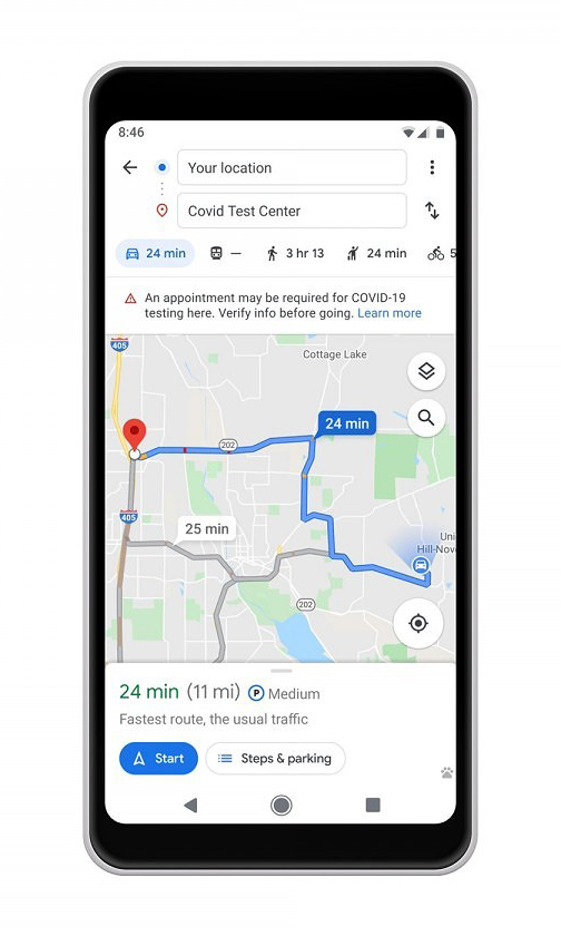
Google Maps will also help you when navigating to COVID-19 testing centres by displaying an alert to help you to verify eligibility and facility guidelines so you are not turned away when you arrive. These alerts will only be available in Indonesia, Israel, the Philippines, South Korea, and the U.S. at this stage with hopefully more to come in the future.
The COVID-19 pandemic is far from over and it is good to see services such as Google Maps pivoting to help us survive in it. Don’t be surprised to more additions to Google Maps and other Google services in the future although of course we all hope that none of us will ever need them. Stay safe.