Last week, Google updated Maps to version 8.0, and while we gave you a quick rundown of the new features, it’s worth taking a closer look at some of them and showing you the new interface for navigation, route planning and more. Google Maps navigation is just about at the point where it’s worth throwing out your crusty old GPS in the car, and using Google Maps exclusively.
There’s some things we don’t get in Australia yet, like lane guidance, but the features we do get certainly improve the utility of an already feature-rich application.
Navigation Interface

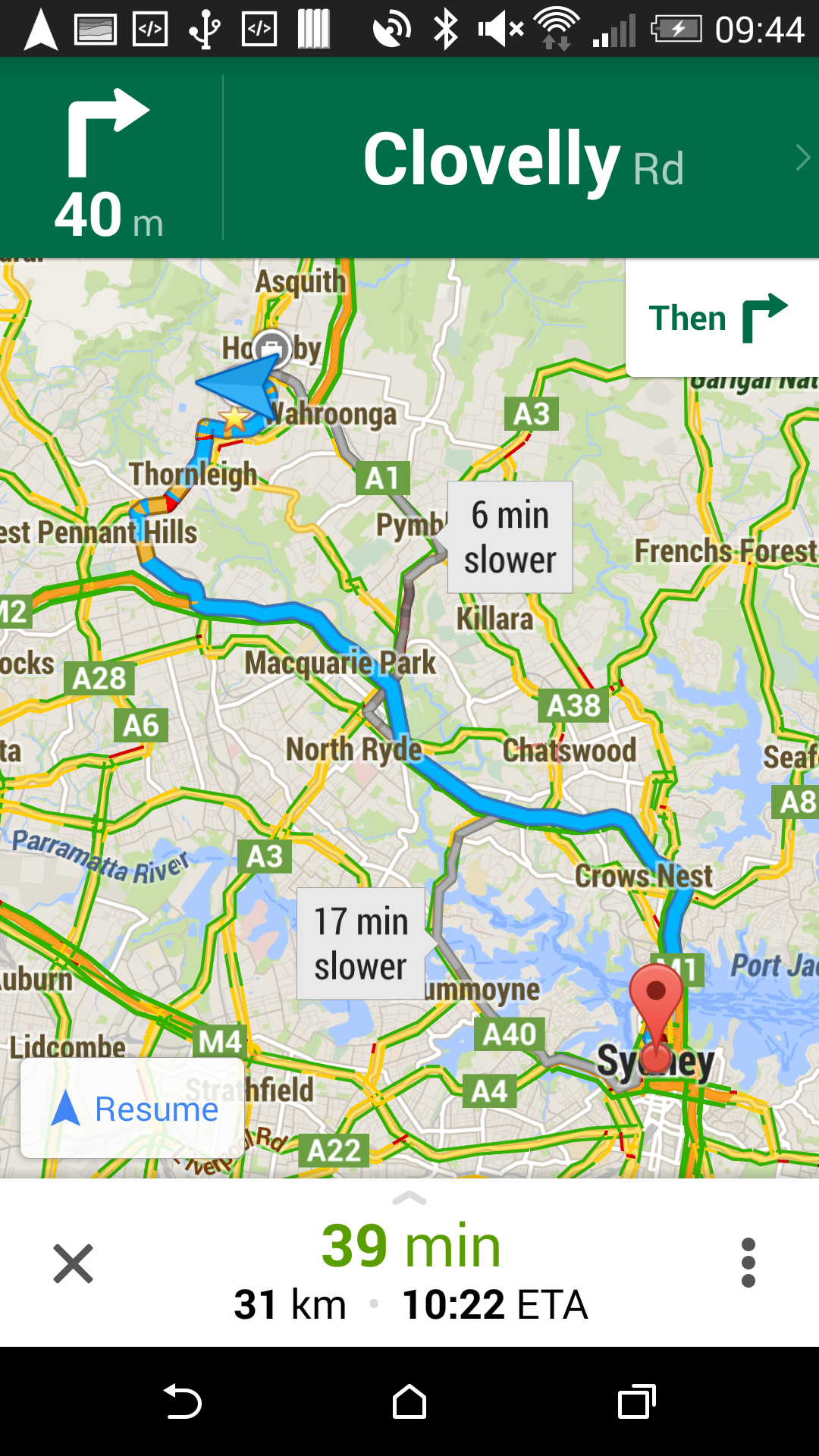
Above you can see the new navigation interface. Immediately obvious changes are the inclusion of more information on the heads-up display; time to your destination, how many kilometers remaining, and your estimated time of arrival. The map display itself hasn’t changed markedly, but there is a new routing button on the right which allows you to quickly (from the nav screen) access alternative routes if you hear that there’s something happening ahead on the radio, or if you just feel like going a different way.
On the right, you can see the route overview / alternative display, and while it’s complicated by the fact that the northern suburbs of Sydney are a bit of a mess, you can readily see a quick overview of where the alternative routes will take you to get to your destination (in this case, from the office to the heart of the CBD). Traffic snarls are readily visible, as are estimates for time variances for the different route options. All in all, it’s a lot of information, but it’s useful information.
Directions and options
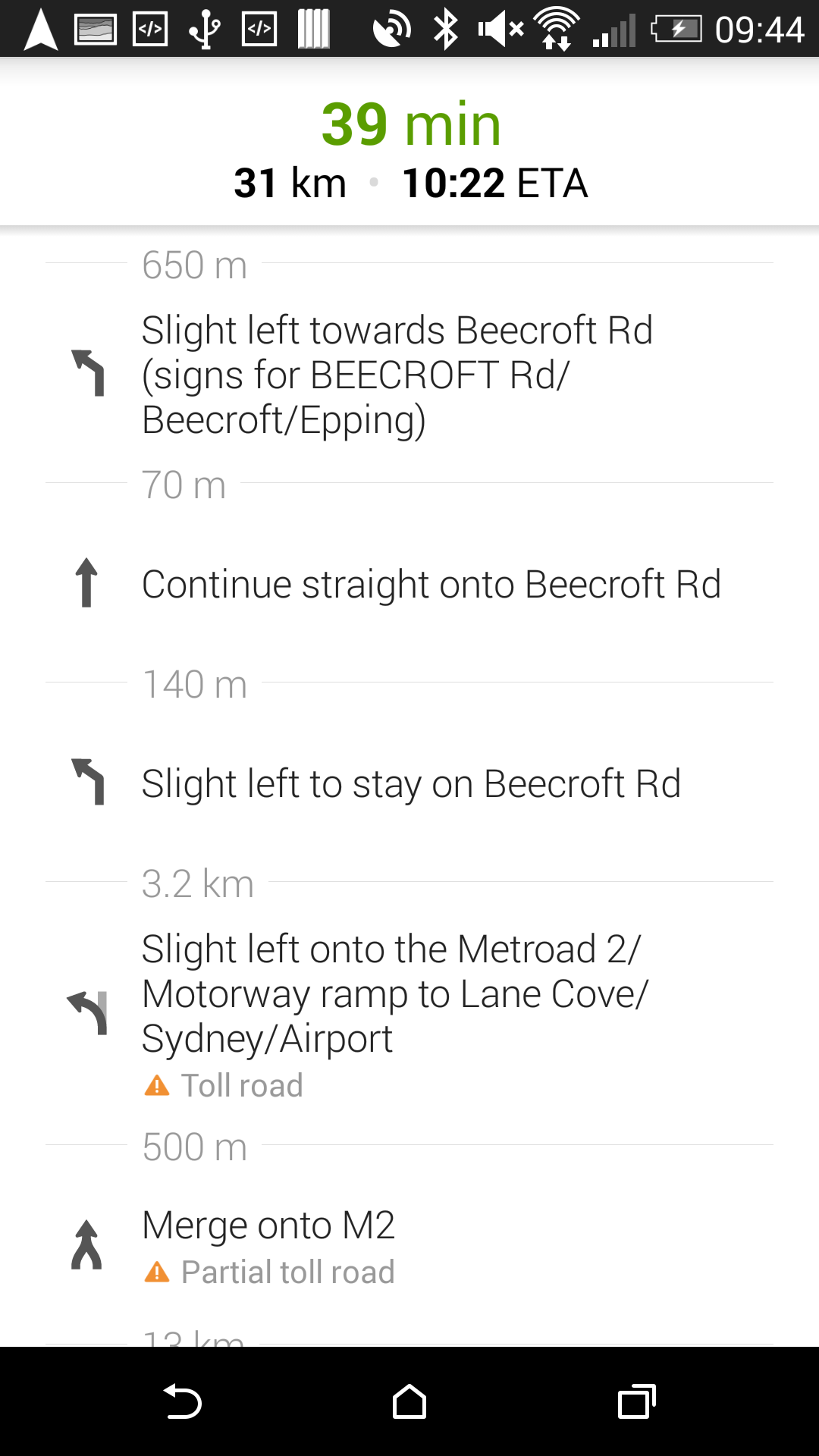
On the left, you can see the overview of directions you need to take in order to reach your destination. Sometimes it’s handy to know which turns are coming up in a list view instead of seeing them on the map, especially if street names mean more to you than graphics. The interface hasn’t changed a lot from the previous versions of Maps, except that the time and distance remaining and ETA are now shown atop the directions list.
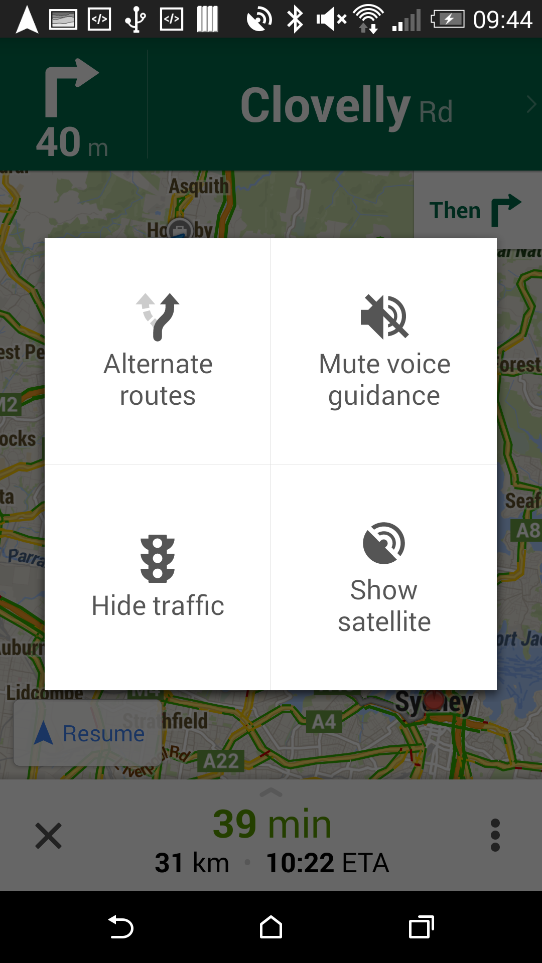
On the right is a quick popup accessible from the three-dot overflow button shown on the main navigation screen. You can access alternate routes (though you probably can access those more quickly by the alternate route shortcut on the map screen, rather than this two step process), turn off the voice guidance if desired, show or hide the traffic layer, or switch from the map view to the satellite view.
These are all options that have been present before; they’re just now a lot easier to access one handed while on the way.
Other new features

Tapping the profile button at the top of a map view (the little icon that looks like a person) brings up your Maps profile, which shows you things like where your home and work are, places you’ve saved nearby, and a new feature: places you’ve been that you can leave a review for. You’ll be offered the option to leave reviews for places you’ve recently navigated to, searched for, or saved as places on your map, including a star rating and a brief text review.
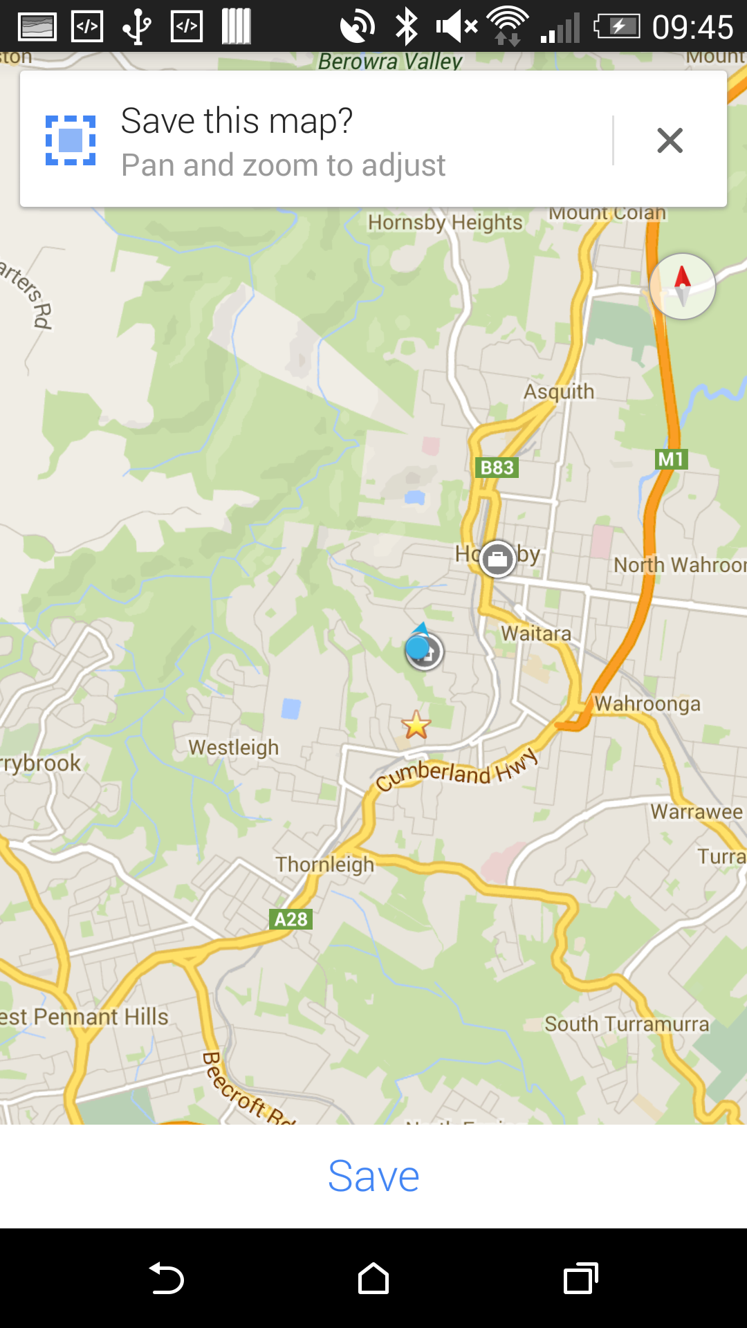
There’s also options for those who like to work offline, with the new offline maps interface making it even easier to save maps to work with when you’re out of mobile coverage areas, or for devices (like tablets) which might not have cellular connectivity. The process is really simple to manage. Pan and zoom to select an area of the map you’d like to save, tap your profile, and scroll to the bottom to manage offline maps. You can then save the current view (including all zoom levels) for offline use. Managing saved offline maps is equally easy; return to this menu and you can view/delete previously saved maps.
Saved offline maps expire after 30 days on your device (at which time you can just re-download them), but it’s an easy way to cache some maps before heading off on a trip (e.g. you could cache most of the foreign country you’re visiting, and save your mobile data when you get there).
What new features have you found in Google Maps that you’d like to share?