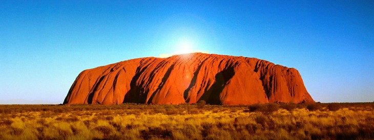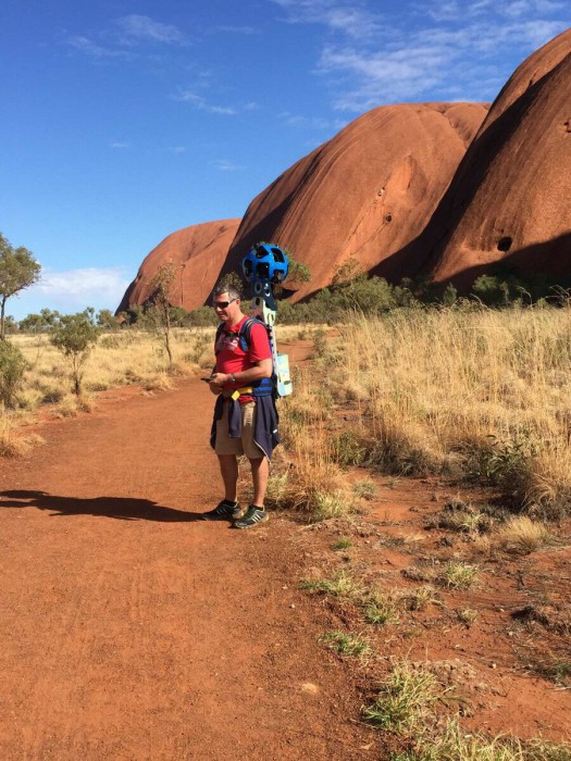
We’ve seen Google add Streetview all over our wide world, from the depths of the Great Barrier Reef to the heady heights of the Himalayas and the Everest base camp, now it’s back to Australia with a trekker spotted wearing the Street View Trekker backpack around the largest sandstone formation in the world: Uluru.
The trekker was walking around Uluru with the backpack capturing images of the walking trails and sights around the UNESCO listed World Heritage Site.

According to a Google spokesperson, the images were captured as part of the Google Streetview trekker program, which has been set up to give organisations with access to hard to reach places the ability to capture amazing images to share on Google Maps – though unfortunately Google advised that there was no timeline to share on when we would see these images.
The rock itself is a beautiful formation comprising of mostly sandstone and is a 450km trip from the nearest large town, Alice Springs. Ownership of the rock, and the surrounding area was returned to the local Pitjantjatjara Aboriginal people in 1985 and as per the wishes of Uluru’s traditional owners the rock wasn’t climbed, so no images were captured from the 348 metre high summit.
The trekker backpack is an interesting piece of technology, comprising fifteen 5MP cameras in a backpack which weighs almost 20Kg. The trekker captures the same 360° images as the Google Maps cars, though in a portable form factor allowing them to capture areas such as the walking trails around Uluru.

While Google had nothing to share on timelines, the redditor who shared the image says he was told that it would be around 9 months before we see the results of the trek. The process to publish Street View images is a fairly long one, which begins with collection. Images captured by the backpack are then matched and aligned using sensors such as GPS, before being turned into the 360° panoramas we know and love.

Uluru is a hugely popular tourist destination, but it definitely fits the bill of a hard to reach destination, and though we may not see the results for a fair while, it will certainly be of interest to a good many people when we do.


Australia is a country which had initially only very low-resolution Street View so it’s good to update this country as much as possible, both offroad and onroad.
Guys, unless you’ve received a media release form from the guy in the shot (looks like photo was taken without his permission) or approval from Uluru national park (background might be a sacred site), you might want to take the photo down…
Thanks for your concern Jesse, as per the post, we contacted Google Australia (they are aware of the article hence the comment from them) and this project is part of the Google Trekker program.
As far as we know Uluru is still a public area and sharing photos taken around the area is still allowed and completely legal and not against the wishes of the traditional owners of Uluru.
Thanks for reading.
Thanks Daniel, though if you’ve looked into the trekker program you’ll know the trekkers are loaned out to volunteers, who don’t work for Google. Also the traditional owners and media that operate at the park are highly protective of culturally sensitive areas that can’t be filmed or photographed (if you’ve been to the park, you’ll see signage everywhere saying ‘please don’t film’). While there’s a chance this shot might not be in a sacred area, you can’t be sure unless you check with them. I wouldn’t normally make a comment about, but thought as a reputable news/media outlet you might… Read more »
Hi Jess,
We’re pretty familiar with the Trekker program, thanks for your concern, but we are fine. The photo is in a public area and all walking tracks are in the clear.
If you would like to identify yourself as you seem overly concerned with this issue, please contact me: Daniel AT ausdroid DOT net to continue
Sorry Daniel, didn’t mean to interrogate (reading back it sounded quite rude), I just thought this poor guy was unknowingly having his face plastered across the web. All good.