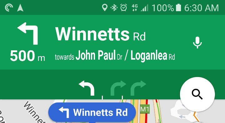
Since they introduced turn-by-turn navigation in Maps, two requested features have been at the top of the list: Speed limits and Lane Guidance. It appears Google is fixing both of these, with speed limits now appearing – and as we’ve seen on the drive to work this morning, lane guidance in Australia.
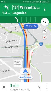
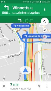
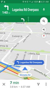
As you can see in the screenshots above the new lane guidance shows all the available lanes, indicated by dividers and direction arrows, as well as which lane you need to be in, indicated by the solid white arrow. One important distinction here is that these are the lanes at your next ‘decision point’. IE these may not be the lanes available to you now, they are what you will be faced with next time you need to turn, merge or even stay on the same road.
That said knowing where you eventually need to be should be enough to let you know which lane to be in leading up to that point. During our brief test this morning the new system worked on all the roads we tried, however, there can be a slight delay with the information displaying so we think that this information is only server side at the moment and may not yet be included in the offline maps storage offered in Google Maps.
This feature will be great in places you’re not familiar with that have complicated road systems, I’m looking at you Launceston with your crazy maze of one-way streets. It’s great to see Google continue to develop Google Maps and we can’t wait to see what comes next.
Have you noticed lane guidance on Google Maps? Let us know below.



I’ll have to test it driving over the Bolt Bridge. It splits into three lanes going off into three directions, and that can be a panic and result in driving around the back streets of Docklands trying to get back on track.
I hate that bit of road!
Let us know if it works!
This is great. I used it about a year ago in South Africa. Good way to make sure what lane you need to be in when it’s not clear.
I noticed lane guidance yesterday in a trip through the northern suburbs of Melbourne. Very helpful and worked flawlessly during my journey.
As for whether lane guidance works with offline maps, someone might be able to shed light on this info – I have Melbourne downloaded as an offline map but I was connected to 4G at the time I was using it. Will navigation (and lane guidance) get pulled from Google’s servers or my phone in this instance?
If it comes from the phone, even when connected to cellular, then I can confirm lane guidance is working offline.
I’m certain this used to be there earlier in the year. At least I had it when I first got my Android Auto…then it disappeared. Glad to see it back though 🙂
Yep, I started noticing it yesterday. I commented on a Reddit thread and someone said that they have had it for a while in Perth??
This is great news. A great app getting better. When I was driving in America lane guidance was great, their freeways are also better signed with exit numbers.