We’re very lucky in Australia to have such beautiful national parks to explore and wildlife to observe. We’re also pretty lucky to have great quality air to enjoy on our adventures. Not all countries are as lucky as we are and, in bushfire season particularly, there are times our air quality isn’t great either.
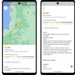
As part of the continued efforts to make Google Maps a go-to app, a new air quality layer is being added. This will help to understand how healthy (or not) the air is. As you can see from the screenshots, this is being presented in an accessible and easy to understand, visual way.
The information is provided by trusted government agencies with associated health advice for those at risk of flow on issues.
For those looking to turn on the layer, you simply need to tap layers and enable the feature.


no air quality on the new iphone weather app