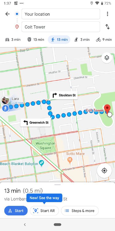
Yesterday Google officially announced their new AR feature to aid navigation while walking and that it would be rolling out to Pixel users imminently. They weren’t kidding it seems with the new Maps feature rolling out today.
Here in the US AR for Navigation has appeared on Pixel phones this morning and confirmed by members of the team in Australia too. AR within Google Maps uses Google’s knowledge of the buildings surrounding streets from their Street View app. Google locates landmarks on these buildings and uses this to create and give an AR navigation directions.
Google Maps meets AR.
Rolling out to Pixel phones, starting today. #io19 pic.twitter.com/rDBxvbZyF8
— #GoogleMaps15 🎈 (@googlemaps) May 7, 2019
The entire process only takes a seconds after pointing your Pixel’s camera at a building nearby. For a phone to be able to run this it must support AR Core and have Street View (and of course Maps). At this stage it is only available for Pixel devices but is expected to roll out to other compatible devices in the not to distant future.

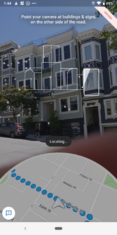
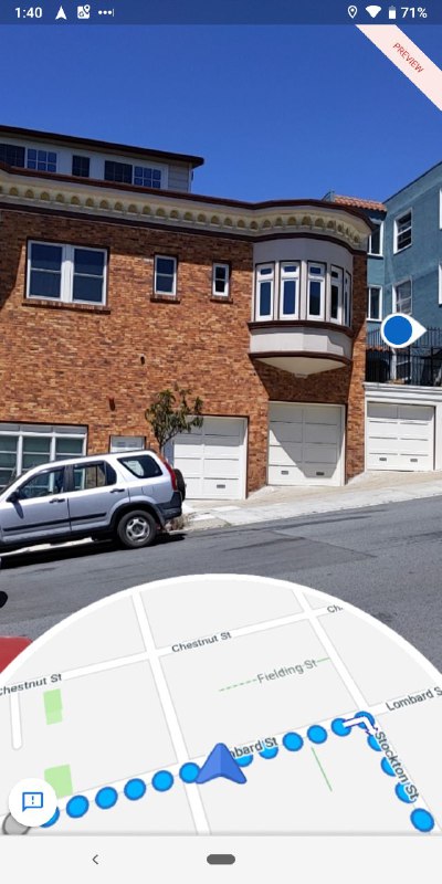
If you are out wandering the streets today try it out — I think you will be pleasantly surprised with the functionality and just how handy it is.