Google is celebrating a significant milestone for one of its most-loved services. Maps is turning 15 this weekend, and the company is looking to shine a light on its achievements along with a few other notable Aussie inventions.
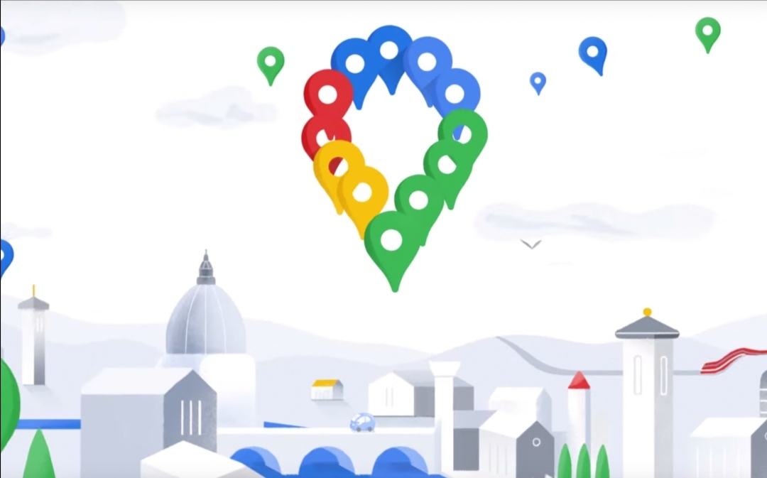
Google Maps is also getting a new logo for its 15th birthday – an updated version of the service’s now-famous pin, done up in Google-y colours. In some ways the multicoloured pin reflects the product’s focus on places – getting you to them, letting you know what to do once you’re there, and helping you to tell others about them.
And so, it’s a big hello-and-welcome to the new Google Maps logo, on the eve of its birthday.
The new icon should also help users stop confusing it with Apple’s own Maps product on iOS devices.
Australian Made
In case you didn’t know – and Google’s pretty sure that this is true of a lot of us – Google Maps began in Sydney Australia 15 years ago this weekend when soon-to-be-Googlers Noel Gordon and Lars Rasmussen sold their startup to the company and started building a service that would touch almost everyone on the planet.
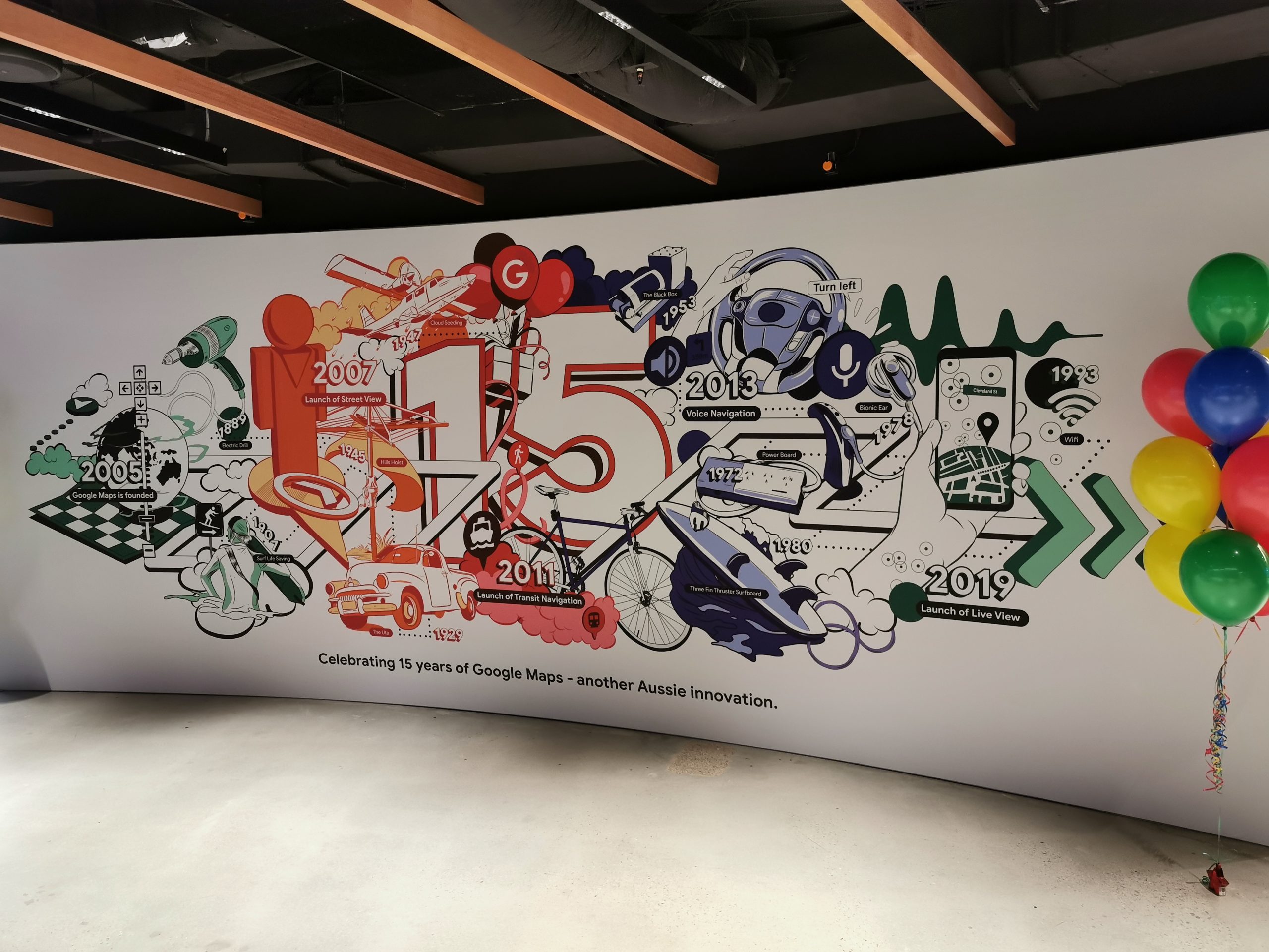
Google wants to shine a light on Australian innovations as it celebrates Maps’ birthday, highlighting some of our contributions to the world like the Electric Drill, the Hills Hoist, the Ute, the Power Board, the Bionic Ear and Wifi. There’s a fantastic mural in the company’s Sydney office that comes to life when viewed inside Google Lens, celebrating these achievements.
Google Maps has become an essential part of our daily lives. I open the app every morning as I leave home to find out when bus well arrive, I plan where to go out for dinner in unfamiliar areas by looking for well-reviewed restaurants, and I’ll use the navigation feature several times every week to help me get where I’m going.
It wasn’t always this way, though. It’s hard to remember life before Maps, but I’m pretty sure it was a combination of Melway street directories and asking a lot of strangers how to get somewhere, with a lot of communal head-scratching.
To help us get some perspective on the genesis of Maps, Google was kind enough to invite us to hear from Noel himself about some of the challenges and trials they faced in the early days and while building the service at an event in the company’s Sydney office this morning.
In its pre-Google days, Maps was a dedicated application written in C++ which was converted to a web application by the team in a stunningly short timeframe (just a couple of weeks) in order to close the deal on acquisition. At launch, the map was built of images loaded from a remote server and tiled into your viewport as you zoomed in and out.
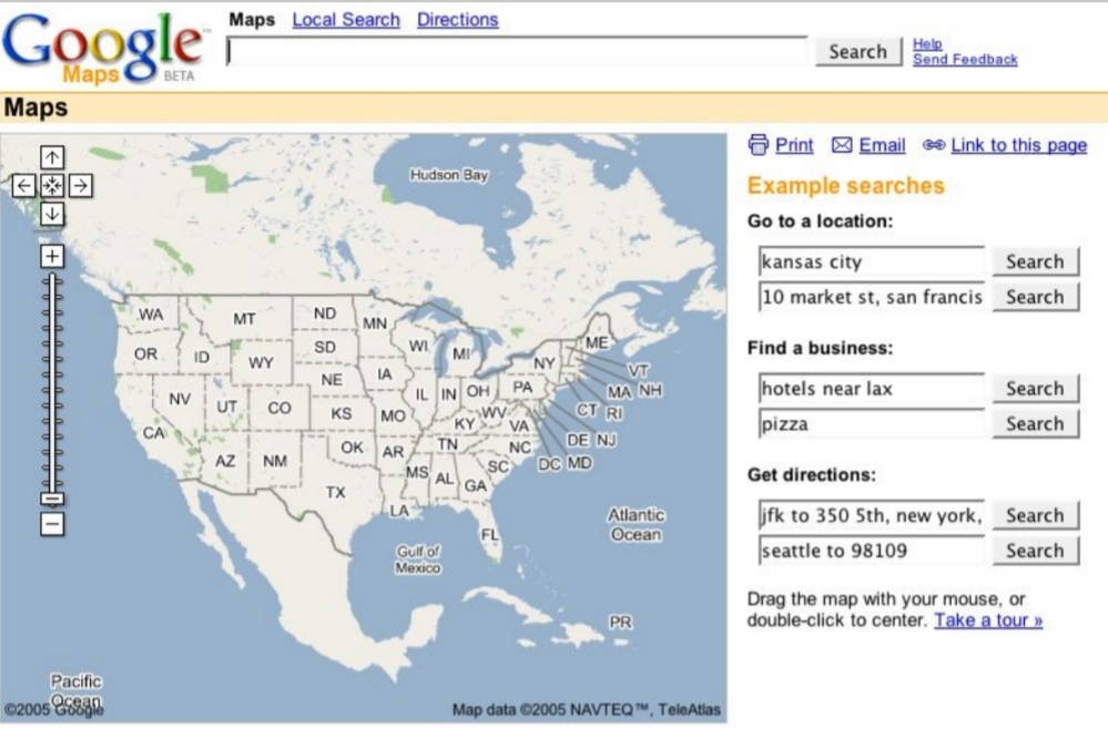
It also l launched with only North America on the map, bringing more countries online as Google got access to data needed to build maps of those countries. Oh, and they also invented AJAX to help make their application work in browsers of the time.
Today, Maps has information on some 200 million places or points of interest, detailed maps of 220 countries and sees people driving over 1 billion kilometres guided by its navigation tools daily. You might say it’s done well for itself.
Of course, you can’t place an Ausdroider in the same room as Google royalty without a selfie happening. Sorrynotsorry.
Even with 15 years of innovation behind it, Google’s not done yet. Noel says that engineers coming in to work on the product tell him that it represents the biggest challenge of their careers, and there’s always a lot of work going on.
I asked Noel what the most surprising development he’s seen in Maps was, and his answer is only slightly surprising – it’s the rooftop advertising that some buildings show up in Maps’ satellite view. Enterprising individuals indeed.

Local Guides play a huge part
Google also wanted to remind us today that much of the data in Maps that we rely on – photos, phone numbers, web links, menus, and reviews – come from individuals like you and I, the locals who know the areas best.
The company’s Local Guides program has been running for a few years now, gamifying users’ contributions to Maps with an ever-increasing scale encouraging you to contribute more and level up. It’s working pretty well – Google’s Dane Glasgow told us they see more than 20 million contributions to Maps each day, be they map alterations, changes to listings, new photos, or more.
Google appreciates its Local Guides, and introduced us to Penny Christie, a Sydney Local Guide with the distinction of being a Level 9 contributior to Google Maps. She’s uploaded over 10,000 photos that have been viewed 70 million times. I thought I was doing well with 186 photos and 1.3 million views (I’m level 6).

Google rewards its contributors in various ways. Sometimes there’s some Google products and services. Sometimes there’s other collectables. While I’m majorly into collecting Google’s pins representing their products and services (among others), the Local Guides program offers a few exclusive pins I can really only dream of one day placing on a pin board. They’re like gold.
Penny of course has some cheerful advice for getting my hands on these pins – just keep contributing. She’s right, of course – Maps invites more contributions than ever before, with push notifications, in-app suggestions and simple use interfaces helping the company reach that 20 million count every day. My contributions have certainly spiked in the last year.
Some new tricks
Not content to let Maps’ 15th birthday go by without some changes, Google today announced some new features for Google Maps Commute, with new attributes on offer like Temperature, Accessibility, Security, the number of carriages and whether there’s a dedicated women’s section (and whether it’s respected by other commuters).
Maps’ nascent Live View navigation feature is also getting a helpful addition with the final destination and distance to it now shown in the AR view of the world.
We’ve seen the company revamp Maps’ in-app navigation tools in the last few months as well, with the change of app UI to five tabs (Explore, Commute, Saved, Contribute and Updates) today becoming official (if you haven’t already got it). There’s been no changes announced to bring the desktop version of Maps into line with this UI, but with Google I/O just around the corner we may see such an announcement there.
What’s coming next?
Looking to the future, Google sees navigation tools like Live View evolving, and Maps bringing even more information about places and businesses to your fingertips.
We’re getting more demanding with our queries, too – remember when it was amazing and fresh to be able to ask “pizza shops near me”? Now Google has to keep up with questions like “pizza shops on my way home” or “pizza shops open now”.
Google is also looking at using AI to bring more accurate building outlines into the app, so you can more clearly see where one building ends and another begins. They’re also using machine learning techniques to add street names and numbers in locations where official signage is harder to see.
As it turns 15 on Saturday, Google Maps has an updated mission: Assist people everywhere as they navigate, explore and get things done in the world.
Happy birthday, Google Maps – here’s hoping for many happy returns.