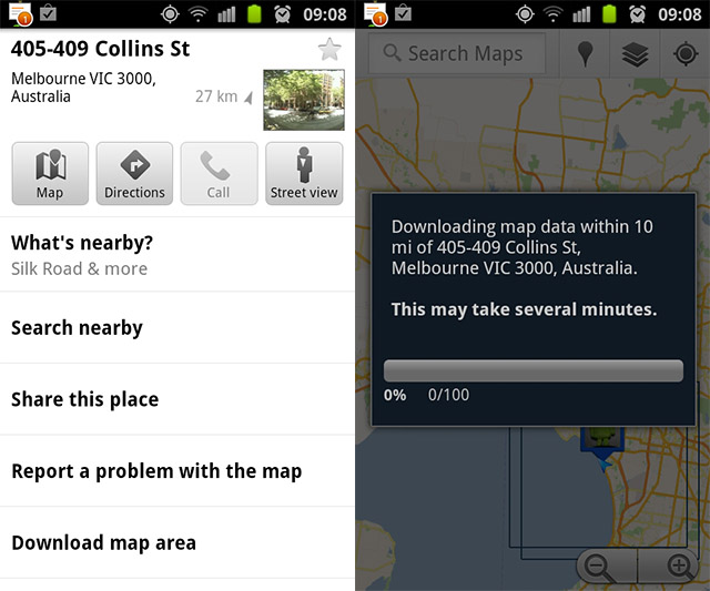
Google recently pushed out an updated version of Google Maps and with this update came the ability to download map data within 16km2 (10 miles2) whilst you have a sufficient data connection, so when you go out into the close-range wilderness you can access Google Maps without the need for 3G or Wi-Fi. Clever. The feature needs to be enabled in the ‘Labs’ menu of the new Google Maps (vers. 5.7.0) and you use it by long pressing on a location, selecting the bubble that appears then hitting the ‘Download map area’ option. Downloaded areas will be shown with a black boxed outline.
The map area downloaded only includes the default map view, so you’ll need data to view satellite view; load up 3D renders of buildings; search for places; and get directions. Since directions are left out, it’s best to know how to get to where you’re going beforehand ;). Hit the source link to download the new Google Maps if you haven’t already.


Someone’s Imperial units isn’t up to scartch 😉 Can’t blame you kids!
10 square miles is 25.8 square kilometers, not 16.
It’s square, remember? i.e., 2D not 1D.
wow, helps if I put in the squared unit, hey? 😛
It would be amazing if you could get directions to someplace and then download the map data for the route.
Well that’s pretty useless if there’s no directions. So you basically have a mini street directory in your phone. I guess it saves on data
yeah, having directions would make it super awesome! though I think having a mini street directory can be quite useful – esp if you are walking. plus being pre-downloaded, i would imagine there would be close to no loading time 🙂
Have you also tried out the Latitude Check-ins sharing to G+? Very cool!